Web Address

Tuesday, April 12, 2011

April 12th

I bet you'll like this post...I have so many photos to include!  First things first though; I promised some of Ron's photos from the first few flights.

A view of Dominica out the right side of the aircraft.  Also notice the cloud physics instrumentation on the wing!
Another view of Dominica
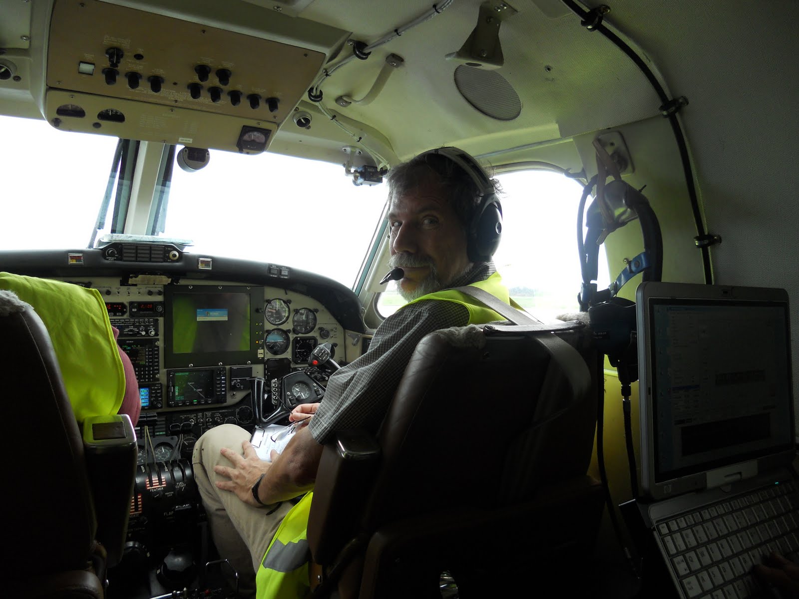
Me with my data display in the back seat of the plane.
We took our first "day off" today being that the weather wasn't great for flying.  The clouds were too deep and convective, and were due to a disturbance from the south.  The overcast sky and poor visibility made it a bad day to visit Mount Pele, so instead we decided to visit the Trinite-Caravelle weather station.  This station sticks out on a peninsula into the Atlantic ocean on the east coast of Martinique.  It is a great station for giving valuable information about the strength and direction of the uninterrupted trade winds.  We drove most of the way there but the last bit had to be on foot and we decided to make a hike out of it and loop back around on a trail.  Unfortunately we were unable to see the weather station up close and personal BUT we got to see a ton of other great things.  On this little penninsula, there were so many different ecosystems!  We passed a region that consisted of bushy-brush type vegetation, then crossed into a rainforest type area, then a coastal region with cliffs, and finally a low lying tidal plain!  We got to see a lighthouse with a great view of the surrounding, tons of crabs and beautiful flowers.  It was wet, muddy, sticky, humid and tropical, but nonetheless it was a great success.  With the exception of a few sunburns on a completely overcast day, it was thoroughly enjoyed by all.
Justin looking out at the Trinite Caravelle weather station.

Rob's masterpiece.


Ron, Justin and I at one of the bay inlets along the cliffy coastline.

Monday, April 11, 2011

April 11th

The last few days have been really busy!  After our scrubbed flight on Friday, ATC permissions came through and we have already gotten 2 complete flights with the altitudes and locations Ron originally was hoping for.  Justin got a chance to fly Saturday, and Rob on Sunday.  Both days were a little on the dry side but the King Air did intersect some rain shafts on both, and the convection remained controlled by the orography.  We've been scrambling to get the quick look data sets online and start to do a bit of a comparison between the flights.  Both flights showed the wind directions approximately Easterly as desired, but the low level trade wind speed was a bit lower than usual.  In the future we will try to fly on more "disturbed" days to get some deeper convection and more precipitation.

DOMEX crew.
 This afternoon we are equally busy but with a different focus.  We are hosting and participating in a "Lesser Antilles Mesoscale Weather Workshop."  There will be 2 hours of lectures, a tour of the aircraft, and a reception.  Ron will give an overview of our project, Dan will talk about the modeling side of our research, and Justin, Rob and I will each give a quick look at data collected over the past week and some of the things we can measure with the aircraft.  Some local scientists will also participate, and the audience will consist mainly of Meteo France employees and associates.  I've got to go fix up my powerpoint but I'll attach some of Ron's in-flight photos a bit later so stay tuned.

Friday, April 8, 2011

April 8th

We flew!!! ...sort of.  Ron and I went over to general aviation, got all set up for a 12:30 take off, waited for a huge rain shaft to pass, and then took off through the thick cloud deck over Martinique.  Upon approach to Dominica, the pilot Brett asked Guadeloupe ATC for permission to fly at a lower altitude but they said no.  Before takeoff we had gotten confirmation that we could fly at 5,000 ft IFR upstream and downstream of the island, but over Dominica, 7,000 ft was the lowest we could go.  However, Guadeloupe ATC would not allow IFR lower than 7,000 ft.  Partly in a way to send a message to the air control people that it is absolutely necessary to go lower, we decided to scrub the flight an hour in. 

Ron in the mission scientist seat up front.
 While the flight was short, I did get to try a hand with the science display and help monitor equipment on the way!  It is really neat to be flying through clouds and be able to see the high relative humidity, both numerically and in a skew-T plot, or be able to see the number concentration and liquid water content peak instantaneously.  The window was next to was tinted with some sort of polarizing film so my pictures won't be very impressive...I'll have to get some from Ron for future posts.
My view out the side window.

My science display.
 In other news, we've moved out of the bed and breakfast to a new house!  It is much closer to the airport, and has a much larger kitchen.  We even have a view of the airport runway and a pool.

Back yard view.

Thursday, April 7, 2011

Wyoming King Air

Unfortunately we did not get to fly today. However, we will almost certainly fly tomorrow. We have not yet gotten permission from ATC to fly below 7,000 ft on IFR (Instrument Flight Rules) and the clouds were too shallow such that flying at 7,000 ft, we would not have been able to measure any clouds. The height of the trade wind inversion was very low today, but it will be much much higher tomorrow. A cold front is going to come through tonight, extending the cloud layer up to 700 hPa or higher. Even if we do not get permission by tomorrow, we will be able to measure clouds at 7,000 ft so it is quite likely that we will fly. While we didn't fly, we did get to visit the aircraft and learn about how the cloud physics instruments work. I'll give you a little overview of some of the instruments below.

This is the Wyoming King Air; it is owned and operated by the University of Wyoming.  It seats four staff members inside, two of which will be occupied by the DOMEX crew each flight.  It is completely decked out with instruments inside and out.
Right Wing Instruments.

Left Wing Instruments.


I'll go through some of them in greater detail...

This is the PCASP instrument which measures aerosol particles.  It takes air (and aerosol particles) in, dries it, and measures the size of particles with an optical particle counter.  It can make measurements 10 times a second!


This instrument measures the liquid water content.  The little wire you see there is kept at a constant ~120C but when water lands on the instrument and then evaporates, it decreases the temperature of the probe.  Power must be supplied to keep the temperature constant and from the amount of power, they can back out the amount of liquid water in the air.
This is the Reverse Flow Temperature probe.  The tubes out the sides are angled such that they create low pressure inside the instrument and air flows around from the back.  By having air flow around, it reduces the amount of water that gets into the instrument.
This is the CIP optical array probe.  A laser is pointed from one side to the other and is focused on an array of diodes.  As particles pass through the probe, they make a shadow on the array.  The laser strobes at a high rate and in this way a picture of the cloud droplets is formed and particle size is measured.
 This is the gust probe.  It sticks out in front of the aircraft and measures winds and turbulence.  There are small inlets on the probe that measure the total impact pressure and the pressure differential on different sides of the probe.  By comparing these to the static pressure, the angle of attack, the ground speed, and many other needed corrections, the wind speed and direction of airflow in the atmosphere can be determined.
 This is the Gerber probe and it measures variables having to do with cloud droplets.  As air passes through the probe, an IR laser measures the amount of forward scattering.  The volume, surface area, and size of cloud droplets is measured. 

This is the CDP probe which also measures cloud particles.  It works in a similar way to some of the other instruments already mentioned; a diode laser is paired with sensing optics and the forward scattering of the laser off of cloud particles is measured.  It also gives cloud droplet spectra information.

I'm sure I've already bored you with all the instrument descriptions so I'll stop there for now.  Two others that don't bode well to pictures are the Wyoming Cloud Radar and the Cloud Lidar.  One person could spend their entire lifetime on a data set as big as the one we're about to be getting...1 flight down, 19 more to go!

Wednesday, April 6, 2011

April 6th

Things are coming along quite well. So far, no problems with the aircraft or the data, just a few issues with air traffic control permissions. We have not yet gotten permission to fly above Dominica at the low altitudes that we'd like. The first research flight yesterday was flown above 7,000 ft on the high-level legs, about 2,000 ft higher than planned. Weather looks good for a flight tomorrow, so pending ATC(air traffic control) permissions, we may fly! And, not only that, I will be the "assistant" in the back! I'm very excited. I'll get to learn how to use the touch screen which instantaneously plots, or reports data, and help with some of the instrument monitoring. I'll talk all about it tomorrow. :)

We've made a lot of progress on flight analysis. My "quick looks" for the flight legs and plots have been coming along nicely, along with Justin's entire data matrix. When we get the data from the possible flight tomorrow, we'll see just how long it will take to complete the "quick look" data set and see if it is actually quick. Tomorrow should be a pretty calm day, one with little to no clouds upstream...Friday, if we fly, is looking to be a lot more disturbed.

And, since I can't leave a post with no photo, enjoy the view from our porch!

Tuesday, April 5, 2011

The Beginning


Sunday morning Ron went on a test flight with the Wyoming crew while the rest of us worked at the Met Office.  Around the time he came back, it was time to pick Justin up from Fort de France.  He took a ferry from Dominica to Martinique and arrived just in time for a quick lunch, and a trip to the beach!  We drove to Saint Luce and took a swim in the warm Caribbean waters.  It wasn't the typical tropical beach; the shoreline consisted of trees up to the waters edge making a perfect shady spot to avoid the strong sunlight.  The tide was high, the waves large, and the water oh so warm!  Afterward we traveled further into town for a nice French style dinner.  It was starting to feel like a vacation until...

The Ferry from Dominica to Martnique

Beach in Saint Luce


Monday arrived and the workload began.  We went into the Met Office early and worked away all day trying to make a dent on the enormous amount of plots, quick look data sets, derived quantities and other parameters important for understanding the flights.  While Sunday's flight was only a test flight, it was useful for practicing with and for writing the many matlab scripts needed in the long run.  We had our first weather briefing with the met office staff and found it extremely useful.  Their model forecasts will likely be a large part of the decision of whether to fly or not.  We also had a meeting with part of the Wyoming crew.  A similar meeting will take place daily at 3 to keep everybody up to date.

The conference room in the Met Office that we use as our work space.


Sigrid has been doing a great job keeping us well fed!  She arrived with a plethora of sandwich supplies just in time for lunch, and cooked a fantastic dinner complete with chicken, rice, broccoli and salad.  Considering all of the food has been cooked in a tiny little kitchenette, I can't wait until we move into the house on Friday.  With more space, dishes, and a place to store food, the meals are bound to be fantastic.  I also made my first trip to the grocery store today.  Their produce section was huge, they had a large variety of cheese, extremely cheap wine, and some interesting tropical flavors in juices and jams.  The two "best" findings were a beer with 11.6% alcohol content, and a large container of pickled pig parts.  Unique.

Tuesday will likely be a flight day if conditions hold up.  Ron and Dan will be the lucky passengers while Justin, Rob and I continue to work on the data processing.  Hopefully we'll get our first flight in, our first quick look data set created, and make some more progress on some of the plots that will be useful for characterizing the flight legs. 
Dan and Tatoon getting friendly with each other.

The beach at sunset.


Saturday, April 2, 2011

Martinique

I arrived in Martinique this afternoon and my first thought was that it is really really HOT.  It is hot, and humid, and sticky, and sweaty.  This will take some getting used to.  But, I suppose that is what one should expect from a tropical location.  Many of my other expectations were met; mountains topped with puffy white clouds, tropical looking plants, lizards, and French.  The view from the plane as we landed was beautiful - I could even see the sailboats and wind surfers in the bay.  The bed and breakfast we are staying at is homey, and the caretaker is very kind.  While not all the rooms have toilet seats, they do have AC and internet.  Not a bad trade if you ask me.  Anyway, Dan and Rob are supposed to arrive any minute now, and Justin will take a ferry over from Dominica tomorrow.  Then we'll have the full crew here.
Sailboats and Wind Surfers (view from the airplane)

Ron will take a test flight with the Wyoming staff tomorrow to check the instruments one last time and make sure they don't overheat in the tropical sun.  The rest of us will hopefully do some exploring and make sure everything is ready to go for Monday which is the first potential flight day.  The office that we will be using is actually a conference room in the Met Office at the airport.  It has plenty of table space, and will be close to the Met Office staff to hopefully allow for some interaction.  Not too many people were in when we stopped by earlier given that it is Saturday, but hopefully we'll meet them Monday.

Fort de France (view from the airplane)

Justin finally had some success with the netcams on Dominica, the twice-daily soundings from Guadeloupe began today, and the data from previous test flights look correct.  Couldn't ask for a better start to DOMEX.